At peak times this walk can be very busy.
Lava flows, an active crater, steam vents, emerald-coloured lakes and magnificent views combine to make this an unforgettable walking journey.
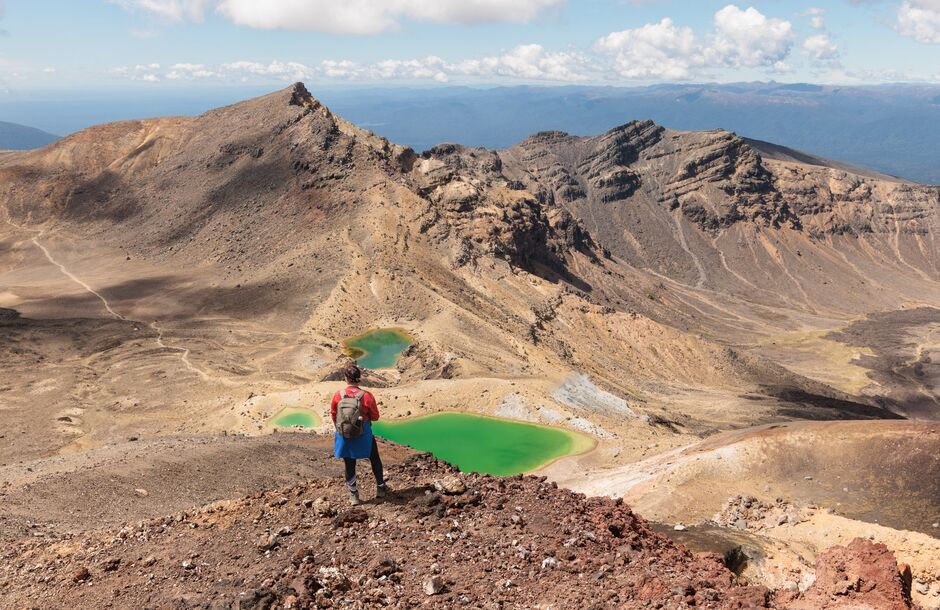

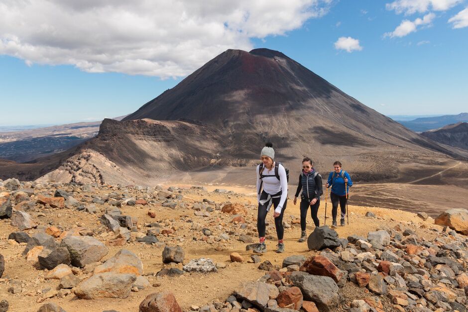
Often described as New Zealand's greatest day walk, the Tongariro Alpine Crossing is a challenging journey across a remarkable volcanic landscape.
For the latest information on access to Tongariro National Park please refer to the Department of Conservation's Tongariro Facebook page(opens in new window).
You can walk the track in either direction, but the more popular option begins at Mangatepopo Valley.
Beginning at Mangatepopo Valley near Whakapapa, the track follows a stream and the edges of old lava flows towards the valley head. Look out for varying patches of vegetation that reveal the age of the surrounding lava rock.
At the head of the valley, the trail becomes steeper, climbing from the valley to Mangatepopo Saddle between the mountains of Ngauruhoe and Tongariro. Stunning panoramic views look out over the volcanic terrain. On a clear day, you can see as far as Taranaki Maunga (mountain).
The trail leads from South Crater upwards towards Red Crater, the highest point of the Tongariro Alpine Crossing. The smell of sulphur is a reminder that this crater is still active.
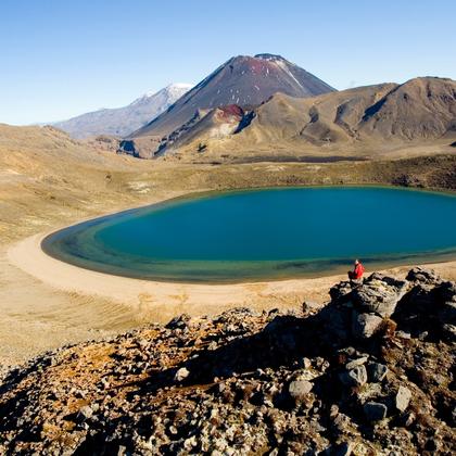
From here you begin the descent, past the stunning Emerald Lakes. This is the highlight of the track and a great place to pause for photos.
The brilliant colour that gives them their name is caused by minerals leaching from the surrounding thermal environment.
The trail continues over Central Crater to the old volcanic vent of Blue Lake, before it rounds the flanks of North Crater and descends to Ketetahi Road end. The final section is a long descent through tussock slopes to cool green forest, a refreshing change to the volcanic landscape.
Plan My Walk takes the guesswork out of your preparation by bringing together the right information needed for planning a safe and successful walk or tramp.
Plan My Walk - Tongariro Alpine Crossing(opens in new window)

Department of Consevation provides detailed information about this trail, accommodation, gear list, and safety information.
The Tiaki Promise is a commitment to care for New Zealand, for now, and for future generations.