
Easy to intermediate
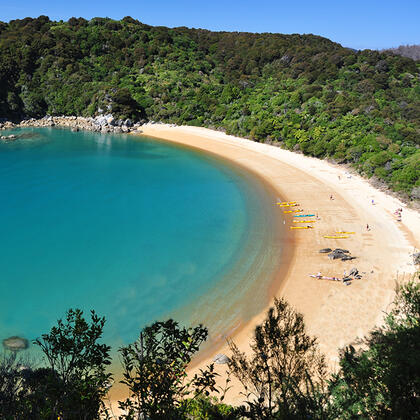
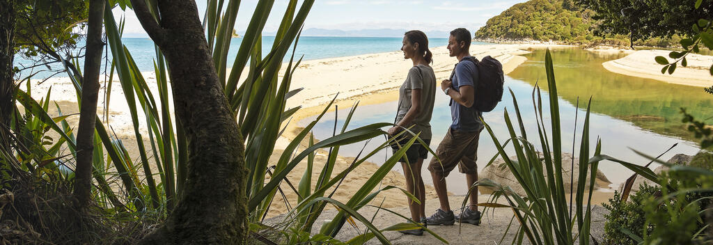
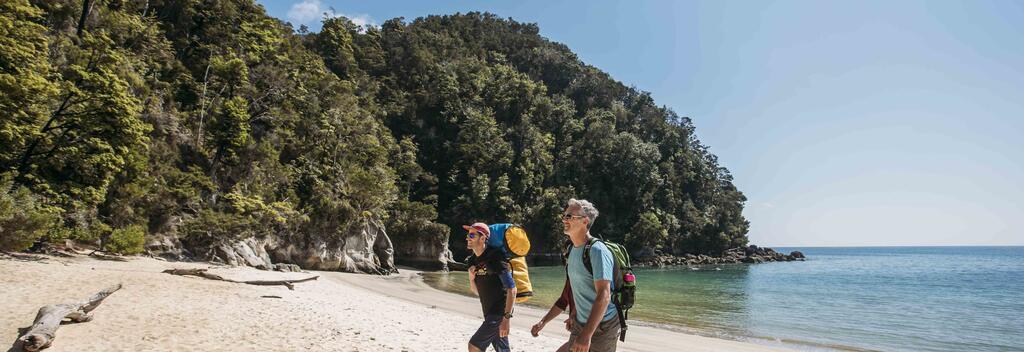
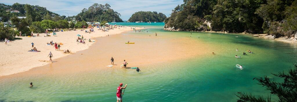
New Zealand’s Abel Tasman Coast Track is a 60 km trail of golden beaches, forested headlands, and crystal-clear bays.
Find out what you need to know to hike the Abel Tasman Coast Track. It’s one of Aotearoa New Zealand’s Great Walks – a network of premier multi-day hiking trails that showcase the country’s most spectacular natural landscapes.

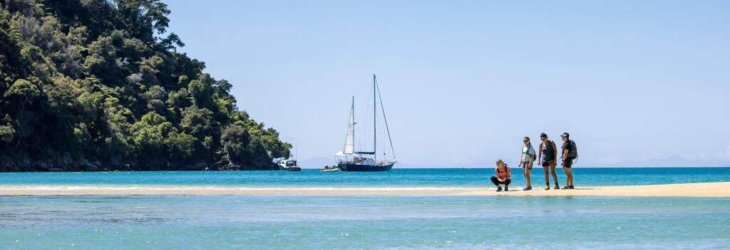
The Abel Tasman Coast Track takes you through one of Aotearoa New Zealand’s most picturesque coastal landscapes. Thanks to the mild climate and low elevation, the track is one of the few Great Walks in the South Island that can be hiked year-round. Most hikers walk the full length over 3-5 days, though many opt to take a water taxi or kayak part of the way.
This well-marked track can be walked in either direction. The following notes describe the track from south to north, highlighting key sights along the way and giving approximate travel times between locations.
Some areas of the track can only be walked at low tide, so it is important to plan your walk according to the tides. Tide timetables can be found at Department of Conservation(opens in new window).
Day 1, Mārahau to Anchorage Bay, 12.4 km (4 hr)
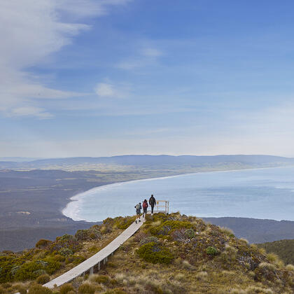
Start by crossing the Mārahau estuary via a causeway. Walk through open country to Tinline Bay, then follow the track around Guilbert Point to Apple Tree Bay. Continue through beech forest and kānuka trees, then head inland before reaching views over Torrent Bay and the northern coast. Finish with a descent into Anchorage Bay, where there’s a hut and a campsite.
Day 2, Anchorage Bay to Bark Bay, 8.4-11.5 km (3-4 hr)
High tide route: 4 hr, 11.5 km
Low tide shortcut: 3 hr, 8.4 km
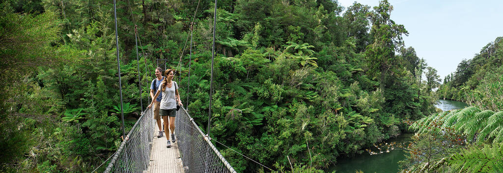
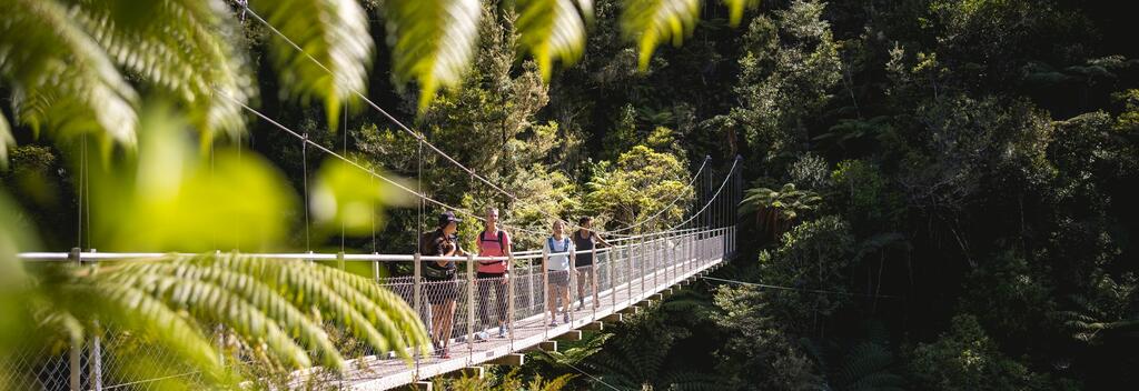
From Anchorage, cross a low ridge to Torrent Bay. You can either follow the track around cross the estuary within two hours of low tide. Stay on the public track through Torrent Bay village. The trail then winds through valleys and forest, crossing the 47-metre Falls River suspension bridge. It finishes at Bark Bay, where there’s another hut and campsite.
Side trip – Cleopatras Pool
Take the 40-min return track to Rākauroa/Torrent Bay high-tide track junction. Here, you’ll encounter Cleopatras Pool, a beautiful swimming hole with a naturally occurring moss-lined waterslide.
Day 3, Bark Bay to Awaroa, 13.5 km (4 hr 30 min)
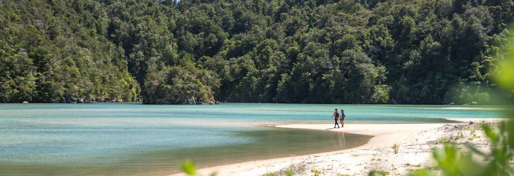
Cross Bark Bay estuary within two hours of low tide or take the 10-minute all-tide track around the edge. The trail climbs through mānuka forest to a saddle, then drops back to the coast at Tonga Quarry. Just offshore is Tonga Island, part of a marine reserve, which is great for snorkelling. From there, cross the inlet at Onetahuti Bay via a boardwalk and bridge, then climb over Tonga Saddle before descending to Awaroa Inlet and the hut.
Day 4, Awaroa to Whariwharangi, 13 km (5 hr 30 min)
Start by crossing Awaroa Estuary – check tide times carefully, as it’s only passable a couple of hours either side of low tide. After crossing, the track climbs over a low saddle and drops into Waiharakeke Bay, then winds through forest and beaches. You’ll pass a lookout with stunning views and hear native birds like tūī and bellbird in the bush. The walk finishes at Whariwharangi Bay, where a restored farm homestead serves as the campsite.
Day 5, Whariwharangi to Wainui or Tōtaranui, 5.7 km / 9 km
Whariwharangi to Wainui, 5.7km (2 hr)
Whariwharangi to Tōtaranui (via Gibbs Hill), 9km (3 hr)
From Whariwharangi Hut, follow the stream and climb to a saddle above Wainui Inlet. You can either head down to the Wainui carpark (2 hr) or turn left and take the Gibbs Hill Track to Tōtaranui (3 hr). The Gibbs Hill route is steep but scenic and connects to water taxi services back to Mārahau.
Kayaking paddling times
Many hikers chose to kayak part of the way. Below are rough paddling times for experienced kayakers in calm conditions (without stops):
Kayaking is not recommended north of Onetahuti Bay due to the remote and exposed coastline.
Kayaking is more weather dependent than walking along the Coast Track. Book campsites that are within your kayaking ability and plan for the worst weather – head winds and rough seas. Check the weather forecast(opens in new window) before you depart.
Never risk your life by kayaking in dangerous seas.
For information on kayak hire, visit Abel Tasman(opens in new window).
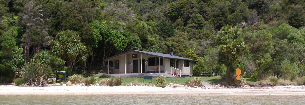
There are 4 huts and 18 campsites along the Abel Tasman Coast Track, which must be booked in advance.
The huts have bunks, mattresses, heating, toilets, basic cooking facilities, solar-powered lighting, and cold running water. But they do not have food, cooking utensils, showers or bedding.
The campsites have basic facilities, including toilets, sinks and a water supply. Campers need to carry their own gas cookers. Unfortunately, campers can't use the hut facilities.
Hut and campsites need to be booked in advance, regardless of the time of year. Visitors arriving without a valid booking or staying at a hut or campsite other than the one named on their ticket, will be charged a penalty fee or may be asked to leave the park.
For more information about the accommodation facilities and how to book them in advance, visit the Department of Conservation(opens in new window).
To simplify the planning process, book through a tour operator. They manage all aspects of the trip, such as bookings, accommodation, transport, and logistics.
Recommended operators:
If you are hiking independently, you will need to book accommodation through the Department of Conservation(opens in new window) or Wilson’s Abel Tasman.
You will also need to check the forecast for weather(opens in new window) and tides(opens in new window) and be aware of safety protocols. Comprehensive information is available on the Department of Conservation(opens in new window) and Plan my Walk(opens in new window) websites.
There are four main entry points:
Scheduled water taxi pickup locations are Apple Tree Bay, Anchorage, Medlands Bay, Bark Bay, Tonga Quarry, Onetahuti, Awaroa and Totaranui.
Commercial water taxis operate between Mārahau/Kaiteriteri and Totaranui. They are not permitted to go above Tōtaranui, so there is no service to Wainui or the Northern bays.
If you’re walking beyond Tōtaranui, you’ll need to use the Gibbs Hill Track loop back through the northern end of the park.
Most water taxi and kayak companies also offer shuttle buses for their customers.
There are car parks at Mārahau, Tōtaranui, and Wainui entrances. Vehicles are parked at owner’s risk.
Freedom camping is strictly prohibited.
Visit the Department of Conservation(opens in new window) for the latest information on the track, including updates on conditions, booking details, track closures, and hazards.
New Zealand’s weather can change quickly, especially in mountainous areas, and Fiordland's weather is renowned for being unpredictable. Always check the weather(opens in new window) and tides(opens in new window) forecasts for the Abel Tasman Costal Track before you begin.
This is an intermediate grade track so a moderate level of fitness is needed. There are steep and rugged sections and the track requires long days of walking, roughly 4-6 hours. For more fitness tips, visit the Department of Conservation(opens in new window).
It is essential that you pack a waterproof jacket, warm clothing, and sturdy footwear. Please take at least one change of clothing, as it's not possible to dry clothes in the huts. Cotton clothing such as jeans, T-shirts and sweatshirts don't dry quickly so they are unsuitable for this hike.
Huts on the Abel Tasman Coast Track don't have gas cooking facilities or lighting, so you will need to take a portable stove and fuel, and candles with you.
Other essentials include food, water, a torch, sunscreen, sun hat, sunglasses, insect repellent, and a means of communication (mobile phone or emergency beacon). Always pack extra food. Visit the Department of Conservation(opens in new window) website for a full gear list.
Follow the Land Safety Code(opens in new window) to help you stay safe when hiking in New Zealand.
Tell someone your itinerary, including the route, expected return time, and emergency contact details. The Plan My Walk(opens in new window) app is an excellent tool for this purpose.
New Zealand is free of predators, snakes, and poisonous insects. However, mosquitoes and sandflies are common year-round near lakes and rivers.
When hiking, remember to:
• Stick to marked trails
• Use bridges to cross rivers
• Avoid disturbing wildlife
• Take all litter with you.
Note: There is no cell phone reception on the track.
For more information on how to look after New Zealand's natural environment, visit Tiaki Promise.
Several small towns near the Abel Tasman Coast Track offer access points, transport options, and places to stay before or after your walk.

Plan My Walk takes the guesswork out of your preparation by bringing together the right information needed for planning a safe and successful walk or tramp.

The Great Hikes App is a comprehensive guide to plan your New Zealand Great Walk.
Great Hikes app - Abel Tasman Coast Track(opens in new window)

Department of Conservation provides detailed information about this trail, accommodation, gear list, and safety information.

The Tiaki Promise is a commitment to care for New Zealand, for now, and for future generations.