
Great Walks season: 1 November – 30 April
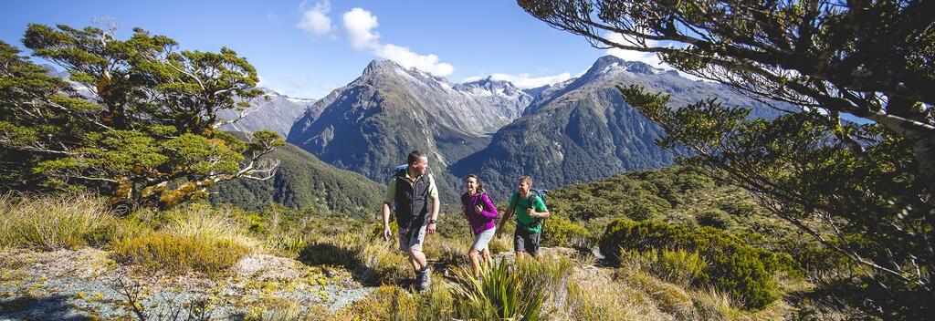
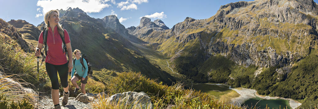
The Routeburn Track is the ultimate alpine adventure, taking hikers across the main divide of the Southern Alps.
Find out what you need to know to hike the Routeburn Track. It’s one of Aotearoa New Zealand’s Great Walks – a network of premier multi-day hiking trails that showcase the country’s most spectacular natural landscapes.
The Routeburn Track is one of the shortest Great Walks, spanning 33 km (19 miles) and taking most hikers three days to complete.
The trail straddles the spine of the Humboldt Mountains, which mark the border between Fiordland and Mount Aspiring National Parks in the south-west of the South Island.
Its historical significance dates to the 1500s when Māori, the indigenous people of New Zealand, used the route to transport pounamu (jade) – a durable stone that was prized as a material for tools, weapons, and ornaments.
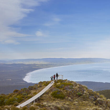
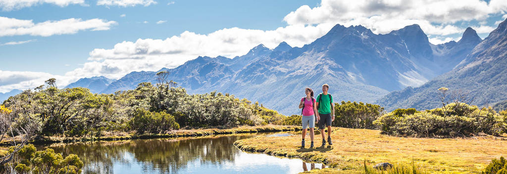
Today, it’s the unique alpine environment that draws hikers. Bookended with subtropical forests, the trail reveals the stark beauty of towering peaks, alpine meadows, and inky-looking lakes – scenery that has empurpled the prose of many writers, including this one.
The Great Walks season (1 November – 30 April, New Zealand’s warmer months) is the best time of year to hike the track. Hiking outside this period is not recommended, as facilities are greatly reduced and snow often covers the track, making it nearly impossible to complete.
This well-marked track can be walked in either direction. The following notes describe the track from east to west, highlighting key sights along the way and giving approximate travel times between locations.
Day 1, Routeburn Shelter to Routeburn Falls Hut, 7.5 km (2 hr 30 min)
The track starts with a relatively easy walk from the Routeburn Shelter, before following the Routeburn River to the Routeburn Flats Hut. You can stop here for the night or continue on another 1.5 hours up to the Routeburn Falls Hut. Note, this section of the track is a steady climb, with the Emily Creek Bridge marking the halfway point.
Day 2, Routeburn Falls Hut to Lake McKenzie Hut, 11.3 km (6 hr)
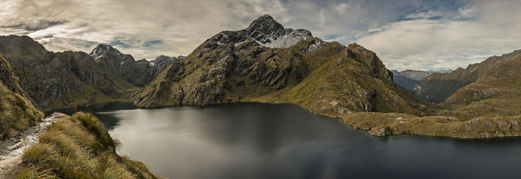
The track climbs steadily up the valley through wetlands and tussock-covered flats to the bluffs above Lake Harris, and continues to the highest point on the track, the Harris Saddle, at 1,255 metres (4,117 feet). If you are exposed to strong westerly winds, head to the Harris Shelter; this is the only shelter available until Mackenzie Hut.
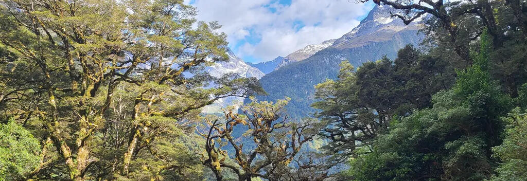
The track then descends along the exposed Hollyford Face, with impressive views of the Darran Mountains. This section of the track is also known for its fine array of alpine plants. Continue descending steadily until you reach Lake Mackenzie Hut, set beside beautiful Lake Mackenzie.
Please note: The above section of track is exposed and can be hazardous in bad weather conditions – it is essential that you have the right equipment.
Side trip: Conical Hill (2-hour return)
This detour is signposted from Harris Shelter. Always stay on the track, take extra food, and ensure you have enough time to make it to the Lake Mackenzie Hut. Don’t attempt this trip in bad weather.
Day 3, Lake McKenzie Hut to The Divide, 12 km (6 hrs)
To start, the track crosses a small flat before climbing steeply to the tree line. It then gradually descends past the ‘Orchard’, an open grassy area dotted with ribbonwood trees, and continues to the magnificent Earland Falls (174 metres). If the falls are in flood, there's an emergency bridge downstream.
The track continues its gradual descent to the Lake Howden toilet stop, then climbs steadily for about 15 minutes to the Key Summit Track turn-off. This is a great place to take in panoramic views of the Humboldt and Darran Mountains. From here, it's gradual downhill walk through silver beech forest to The Divide on the Milford Highway.

To simplify the planning process, book through a tour operator. They manage all aspects of the trip, such as bookings, accommodation, transport, and logistics.
Recommended operators:
If you are hiking independently, you will need to book accommodation through the Department of Conservation(opens in new window). You will also need to check the weather conditions(opens in new window) and be aware of safety protocols. Comprehensive information is available on the Department of Conservation(opens in new window) and Plan my Walk(opens in new window) websites.


You can start the Routeburn Track from either end:
You'll need to arrange transport at both ends of the track.
Recommended transport operators:
Visit the Department of Conservation(opens in new window) for the latest information on the track, including updates on conditions, booking details, track closures, and hazards.
New Zealand’s weather can change quickly, especially in mountainous areas, and Fiordland's weather is renowned for being unpredictable. Always check the weather forecast(opens in new window) for the Routeburn Track before you begin.
This is an intermediate grade track so a moderate level of fitness is needed. There are steep and rugged sections and the track requires long days of walking, roughly 6-7 hours. For more fitness tips, visit the Department of Conservation(opens in new window).
Like all alpine environments, the weather is changeable. At the Harris Saddle, the highest point on the track, the average daily summer temperature sits around 5-10 °C (41-50 °F). Fiordland is also one the wettest places on Earth, receiving 200 days of rain per year. It is essential that you pack a waterproof jacket, warm clothing, warm hat, and sturdy footwear.
Other essentials include food, water, a torch, sunscreen, sun hat, sunglasses, insect repellent, and a means of communication (emergency beacon). Always pack extra food. Visit the Department of Conservation(opens in new window) website for a full gear list.
Follow the Land Safety Code(opens in new window) to help you stay safe when hiking in New Zealand.
Tell someone your itinerary, including the route, expected return time, and emergency contact details. The Plan My Walk(opens in new window) app is an excellent tool for this purpose.
New Zealand is free of predators, snakes, and poisonous insects. However, mosquitoes and sandflies are common year-round near lakes and rivers.
When hiking, remember to:
• Stick to marked trails
• Use bridges to cross rivers
• Avoid disturbing wildlife
• Take all litter with you.
Note: There is no cell phone reception on the track.
For more information on how to look after New Zealand's natural environment, visit Tiaki Promise.
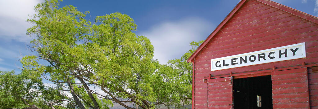
The closest town to the Routeburn Shelter is Glenorchy, about 25 km away. Queenstown, located 71 km from the shelter, is good place to stock up on supplies. For accommodation options in Glenorchy and Queenstown, visit Destination Queenstown(opens in new window).
The closest town to The Divide Shelter is Te Anau. For accommodation options, visit SouthlandNZ(opens in new window). Book in advance during the busy summer months.

Plan My Walk takes the guesswork out of your preparation by bringing together the right information needed for planning a safe and successful walk or tramp.

The Great Hikes App is a comprehensive guide to plan your New Zealand Great Walk.

Department of Consevation provides detailed information about this trail, accommodation, gear list, and safety information.

The Tiaki Promise is a commitment to care for New Zealand, for now, and for future generations.