
Due to recent avalanche activity, some bridges are temporarily removed and the track opening is delayed. Visit the Department of Conservation(opens in new window) for more information.
Intermediate
Retrace the footsteps of early explorers through glacial valleys and alpine regions to the breathtaking Milford Sound / Piopiotahi.
Find out what you need to know to hike the Milford Track in Fiordland National Park, part of Te Wāhipounamu World Heritage Area.
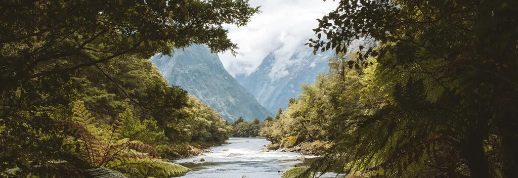
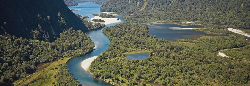
Spanning 53.5 km (33 miles) over four days, the Milford Track takes you through the heart of the Fiordland National Park. This untouched corner of the South Island is jaw-droppingly beautiful, a rare combination of rainforests, glaciers, and towering alpine peaks.
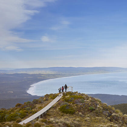
Everyone walks in the same direction, north from the head of Lake Te Anau to Sandfly Point at Milford Sound – a route dating back to 1888. Mackinnon Pass, the mountain pass bearing the name of one of the first Scottish explorers, is tackled in a single day. Upon reaching the summit, 1,154 metres above sea level, hikers are rewarded with epic vistas – weather permitting.
It rains here 200 days of the year, making it one of the wettest places on earth. Like most mountainous regions, snow can occur at any time of the year. For this reason, it is best to walk the Milford Track during the Great Walks season (October to April), when the weather is warmer, huts are staffed by rangers, and avalanche risks are monitored. Attempting the track outside this season requires advanced mountaineering skills.
This moderately challenging hike covers 53.5 kilometres (33 miles) of varied terrain, from easy forest tracks to steep mountain slopes.
Day 1, Glade Wharf > Clinton Hut, 5 km (1 hr 30 min)
Day 1 begins with a boat ride from Te Anau Downs, about 25 km from the township of Te Anau. The scenic hour-long cruise across the Lake Te Anau, the only New Zealand lake with inland fjords, ends at Glade Wharf. From here, it’s a gentle 1-km tree-lined walk to Clinton Hut, your first overnight stop. Nearby are several swimming holes and places to spot glow worms that are worth checking out.
Day 2, Clinton Hut > Mintaro Hut, 17.5 km (6 hr)
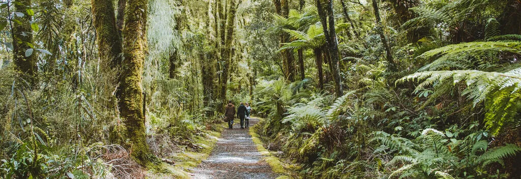
The day begins with an easy walk through moss-draped rainforest, following alongside Clinton River. You’ll make a gradual ascent to Lake Mintaro and catch your first glimpse of the Mackinnon Pass and the Pompolona ice field. This is followed with a stretch of open prairie to Marlenes Creek; then it’s a 2-hour walk to Mintaro Hut.
Day 3, Mintaro Hut > Dumpling Hut, 13 km (6–7 hr)
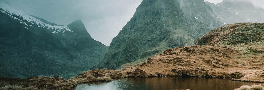
Today, you’ll hike over the Mackinnon Pass, the most challenging section of the trail.
The day starts with a short walk, followed by a steady zigzag up the mountain for about 350 metres. Here, the forest gives way to open alpine terrain, offering stunning views but exposure to the elements. At this elevation the average daily temperature sits around 7-11°C (45–52°F), with rain, strong winds, snow, and freezing conditions being common occurrents, even in summer.
At the summit of Mackinnon Pass, 1,154 metres above sea level, stop for lunch or continue to the Mackinnon Pass shelter. From the shelter, it is a long, steep descent on rocky terrain to Dumpling Hut. This section of the trail has some of the hardest walking but also some of the best views, from towering cliffs and cascading waterfalls to forests laced with moss and glacier-fed streams.
It is highly recommended that you make the side trip to Sutherland Falls, among the world’s highest cascades at 580 metres (1,904 feet). This trip adds an hour and a half of walking, but few regret the journey.
Day 4, Dumpling Hut > Sandfly Point, 18 km (6 hr)
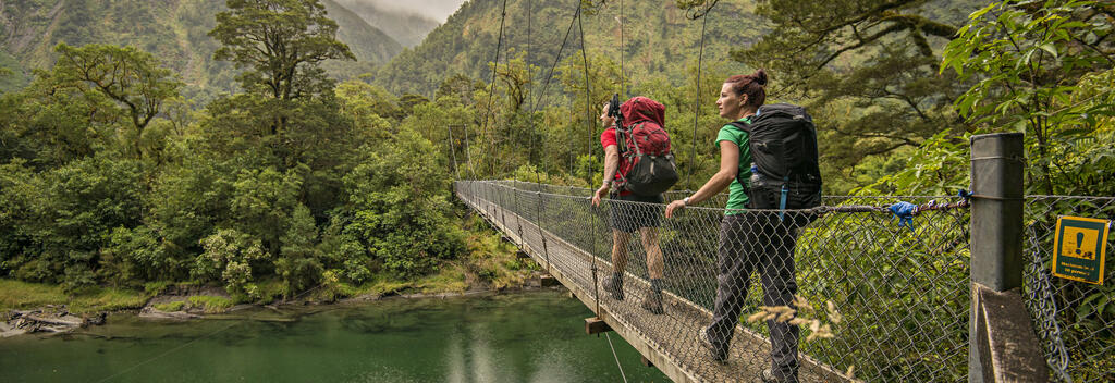
You’ll follow the Arthur Valley all the way to your final stop at Sandfly Point. Along the way you’ll encounter a historic boatshed, Mackay Falls, and Bell Rock, a huge boulder that has eroded from underneath.
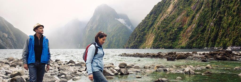
From Sandfly Point, take a short boat ride to the spectacular Milford Sound. To connect with the 2.00 p.m. boat departing from Sandfly Point for Milford Sound, aim to leave Dumpling Hut by 8.00 a.m.
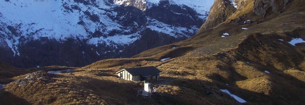
There are three huts along the track that are equipped with bunks, mattresses, heating, toilets, basic cooking facilities, solar-powered lighting, and cold running water. Department of Conservation rangers are in residence at each hut.
The huts must be booked in advance through the Department of Conservation(opens in new window). Fees vary depending on the time of year. Camping is not permitted on the Milford Track.
If you book through Ultimate Hikes(opens in new window), you will be staying at alternative accommodation.
To simplify the planning process, book through a tour operator. They manage all aspects of the trip, such as bookings, accommodation, transport, and logistics.
Recommended operators:
If you are hiking independently, you will need to book accommodation through the Department of Conservation(opens in new window) and arrange transport for both the beginning and the end of the walk.
You will also need to check the weather conditions and be aware of safety protocols. Comprehensive information is available on the Department of Conservation(opens in new window) and Plan my Walk(opens in new window) websites. (opens in new window)
From the town of Te Anau, take a bus or private transport to Te Anau Downs (roughly 30-minutes drive). From there, a boat will take you to Glade Wharf, where the track begins.
At the end of your walk, take a 20-minute boat ride from Sandfly Point to Milford Sound / Piopiotahi, where bus services will take you back to Te Anau or on to Queenstown.
Transport from Te Anau Downs and Sandfly Point must be booked in advance. There is not private vehicle access to the start or end of the track.
Transport providers:
Visit the Department of Conservation(opens in new window) for the latest information on the track, including updates on conditions, booking details, track closures, and hazards.
New Zealand’s weather can change quickly, especially in mountainous areas, and Fiordland's weather is renowned for being unpredictable. Always check the weather forecast(opens in new window) for the Milford Track before you begin.
A moderate to high level of fitness is needed for this hike, which has some steep and rugged sections and requires long days of walking, roughly 6-7 hours. For more fitness tips, visit the Department of Conservation(opens in new window).
Follow these five simple rules, also known as the Land Safety Code(opens in new window), to help you stay safe when hiking in New Zealand.
Tell someone your itinerary, including the route, expected return time, and emergency contact details. The Plan My Walk(opens in new window) app is an excellent tool for this purpose.
Essentials include a waterproof jacket, warm clothing, a hat, gloves, sturdy footwear, food, water, a torch, sunscreen, sunglasses, insect repellent, and a means of communication (emergency beacon). Always pack extra food. Visit the Department of Conservation(opens in new window) website for a full gear list.
New Zealand is free of predators, snakes, and poisonous insects. However, mosquitoes and sandflies are common year-round, lakes, and rivers.
When hiking, remember to:
• Stick to marked trails
• Use bridges to cross rivers
• Avoid disturbing wildlife
• Take all litter with you.
Note: There is no cell phone reception on the trail.
For more information on how to look after New Zealand's natural environment, visit Tiaki Promise.
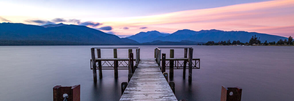
Located just a two-hour drive from Queenstown, the picturesque lakeside town of Te Anau is an ideal place to spend the night before or after walking the Milford Track.
You’ll find a wide range of accommodation options, from backpacker hostels to luxury lodges.
It’s best to book ahead, especially during the busy summer months.

Plan My Walk takes the guesswork out of your preparation by bringing together the right information needed for planning a safe and successful walk or tramp.

The Great Hikes App is a comprehensive guide to plan your New Zealand Great Walk.

Department of Consevation provides detailed information about this trail, accommodation, gear list, and safety information.

The Tiaki Promise is a commitment to care for New Zealand, for now, and for future generations.